Hills to Levels data map
.
Home > Results > Wellhams Brook > Hills to Levels
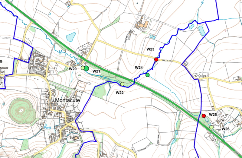
The Hills-to-Levels scheme This page considers the part of the Wellhams Brook catchment that is upstream of the Parish boundatry which runs along the Fosse Way (A303). It is part of a significant flood mitigation scheme called Hill-to-Levels.which includes a number of developments that influence the phosphate concentrations.. The Map shows the area upstream of Montacute, east of the A303 (Fosse Way) outside Martock Parish
|
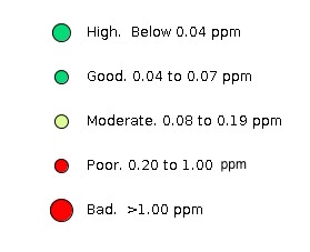
Legend
|
||||
|---|---|---|---|---|---|
Discussion main river (Wellhams Brook) runs near the A3088 road (formerly the Yeovil to Martock railway) from right to left on the map. Upstream it runs on the north side of the road an incorporates several small and one large pond. Phoshate levels are moderate in this section (W26, 0.17ppm, W24, 0,07ppm ). Field margins in this section are generally wide, 6m or more. Just downstream of W24 the Brook joins Balls Water which is significantly more polluted (W23, 0.23ppm). Balls Water flows between cropped fields with no field margins and significant gradients towards the stream. The stream has a weath of aquatic and riparian plants and so tends to be self-cleaning (W22 and 20, 0,16ppm). In this valley, the National Trust, working with Hills to Levels, have constructed a substantial new retention pond which has not yet filled many times and is still not well-stocked with aquatic plants. Nevertheless, the water retained in the pond very rapidly loses any phosphate flowing into it (W21, 0.00ppm). The stream has also been sampled once where it flows under the Fosse Way where and phosphate levels are still relatively low (Venn bridge, W15, 0.11ppm) There is some evidence that the system of ponds that form part of this catchment may be a useful tool for phosphate removal. Initial evidence suggests it is most effective when the ponds are retention ponds in parallel with the streams as this provides a longer time for plants to strip out the phosphate. This mechanism, however, only cleans a small proportion of the overall flow. This is significant as it is essentially the offsetting mechanism under cosideration to protect the Levels. This investigation is incomplete. Photographs will be added. |
|||||
|
|||||
|
|||||